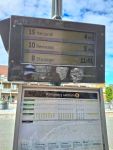
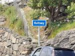
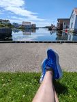
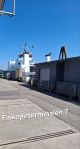
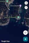
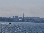
Summer break 2025. Adventure and exploring islands around Stavanger.

VassΓΈy. Thursday July 17th. The day started at 09.30 am for me and the 🌑temperature was already +21Β°C ⛅️.Β  I catch the first 🚍local bus 11.48 am [number 7 from Sola] down to the city centre of Stavanger. It takes approx 18min. A short busride off two stops, [with number 1], just because it goes faster than walking πŸ˜†πŸ˜†. And then catching the ferry towards VassΓΈy island.

Ferry stop 7.

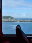
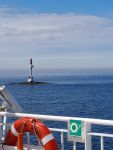
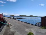
The ferry took about 15 min.

The school of VassΓΈy.
To get to VassΓΈykalven beach you just walk forward on SΓΈrstrandveien. It takes between 10 and 15min depending on how fast you walk. It’s only 1 km. You will end up with the beach on your left side or get to a wooden bathing jetty if you walk the small path in the forest.
VassΓΈykalven beach. Child friendly with permanent grill facilities. Two bathing jetty’s.

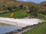
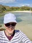
The water temperature is okay today. Maybe +20Β°C.

A bit to much small stones for my taste in the sand while walking out in the water for a swim..

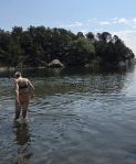
And you need to walk quite far out for the swim πŸ˜” (at least I always needs that πŸ˜…). But it’s very Child friendly because of that.

The toilet facility on the left side and the walking path towards the suspension bridge on your right side.

Before we (me and a girlfriend) headed towards the ferry back to Stavanger ferry port we or I wanted to find the walking path for the suspension bridge over to VassΓΈykalven island  (the calf island).

The marking to follow.
This map picture show you where it is. VassΓΈykalven grill (with the green dot), I didn’t walk there.
We got lost πŸ˜†πŸ˜† but rhus oath led us to this… next picture.
This is Bybrua (the city bridge in Stavanger) from VassΓΈy island side.

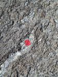
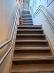
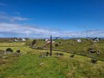
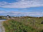
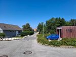
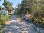
If you walk from the beach towards the toilet facility and then up into the forest on your right side (see picture below) and follow the red paint you will end up at the suspension bridge. It’s no signs more than the red paint “dots”.
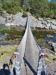
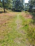
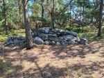
On the top of “the hill” before it goes down hill to the bridge.
The suspension bridge.

And on VassΓΈykalven island you find ruins from some kind of permanent living many (hundred?) years ago.

On the other side of this island it was like a lagoon.

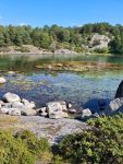
Totally worth a visit! If it warmer than +20Β°C you can also enjoy a swim in the summer. 

Summer break 2025. Adventures and explore.

Tuesday 8th of July. 10.45 am.

Towards KvitsΓΈy island… but first two busses πŸ˜‰.

Bus from my closest bus stop, Stavanger University Hospital Ullandhaug.
Randaberg.
The 🌑at 11.20 am.
Walking up to the ferry..
Not the Best view πŸ˜†πŸ˜† on the ferry.
On the way πŸ˜‰
On the ferry.
We made it.
How to rent a bicycle on the island.
#Paahjul #stavangerkommune #rentabycycle
The first beach few hundred meters from the ferry.
The water here was pretty okay temperature at the public beach.
Area around the lighthouse.
Just me πŸ˜‰ and maybe some πŸ‘πŸ‘πŸ‘πŸ‘.
My friends back closest and the lighthouse of KvitsΓΈy island.
Food break. Sandrenna.
Sandrenna.
Sandrenna.
After the break, we biked away in hope to get to the stone cross. But we were not up for the walk after the 2 km of bicycling (I had only one gear πŸ˜… and lot’s of pain in my legs).

The stone cross is about 4 meter high, you find it at leiasundet, on the far east side of the island. It’s been there for a long time. No one knows how old it us but at least 1000 years.

On our way back to the public beach.
I walked in the water and my friend swam a little. Maybe the water 🌑 was +14 ?πŸ€”.
The ferry port  before we left to get to main land again at 3 pm.

We have had a great adventure and exploring the island as much as we had energy for. We are pleased and a bit sun burned πŸ˜†. Seen as many πŸ‘’s as 🏠-es I think. It was perfect to rent a bicycle to get around! And the ferry is for free if you have a monthly card for bus in Nord-JΓ¦ren.

This picture shows how we were bicycling on the island ;

The Red was the first part to the lighthouse, the Aqua Green is the second part to our first food break.  The Blue is the third part towards the stone cross and the Yellow is back. In total over 6 km.